 |
|
 |
 |
 |
 |
 |
 |
Abasolo Associated Dates: 9000 - 5000 Y.B.P. - Early Archaic to Mid Archaic Morphology: Lanceolate Location: Midwestern United States and Mexico
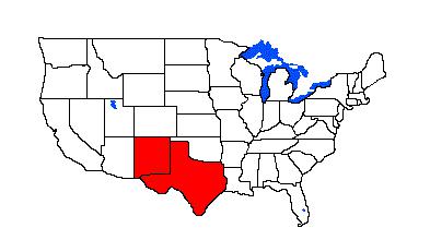
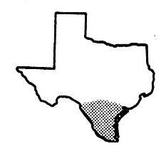
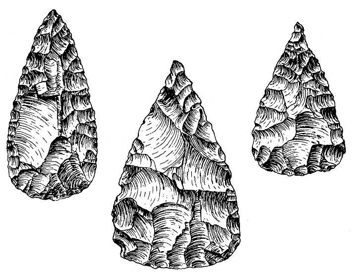
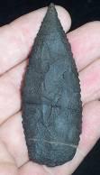
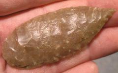
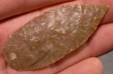
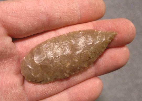
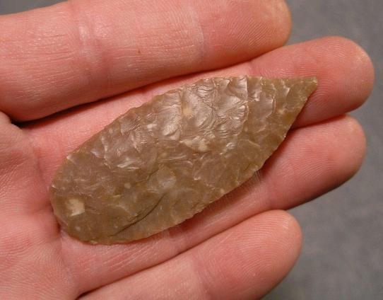
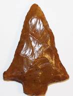
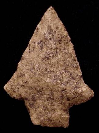
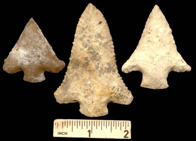
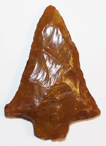
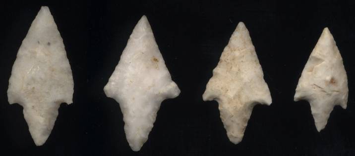
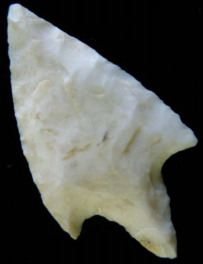
General Description: The Abasolo is a small to medium sized leaf-shaped stemless lanceolate dart point with a triangular blade and a base that is usually well rounded, almost semi-circular but can be on occasion weakly convex. The blade edges are straight to mildly excurvate and the base is most often thinned for hafting purposes. The blade is often beveled, either along the right or left edge of each face but in some cases, the edges are not so much beveled as they are steeply chipped on both edges of one or both faces. The Abasolo is primarily a southern Texas point type and ranges into northeastern Mexico with occurrences of less frequency in adjacent areas. The Abasolo may have also served as a knife rather than a projectile point. It most closely resembles the Tortugas point but differs in that the Abasolo has a rounded base. The Abasolo also resembles the Catan in all respects other than size where the Catan is a smaller point. The Abasolo ranges from 40 mm to 75 mm in length with the width ranging from 20mm to 34 mm. The point was named by R. S. MacNeish for specimens that he found in the state of Tamaulipas in northern Mexico in 1958. The point was described by D. A. Suhm, A. D. Krieger and E. B. Jelks in 1954, prior to MacNeish's publication. (TEXT SOURCE: Art Gumbus, Lithics-Net)
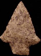
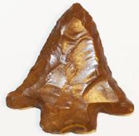
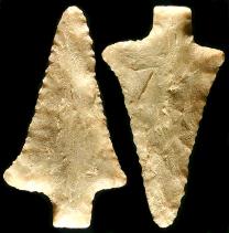
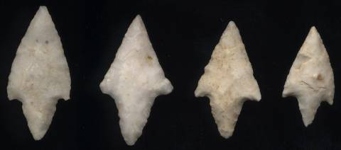
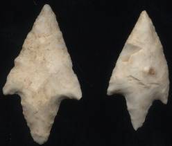
ABOVE: ABA01: Basic Abasolo point shapes. Source: Texasbeyondhistory dot com
ABOVE: ABA02: Abasolo point showing effects of sharpening. A) minimally resharpened; B) moderately resharpened; C) alternate left beveled; D) shortened and narrowed. Source: Texasbeyondhistory dot net ABASOLO POINT THUMBNAIL GALLERY (20 images: 10 source images/10 thumbnails)
End of Abasolo Thumbnails
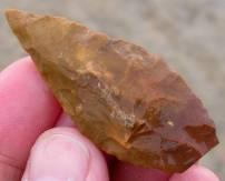
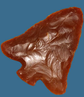
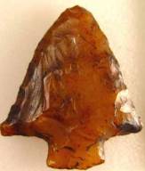
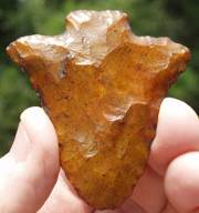
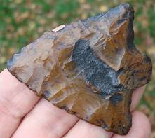
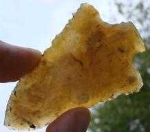
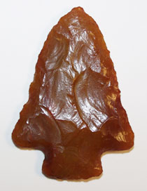
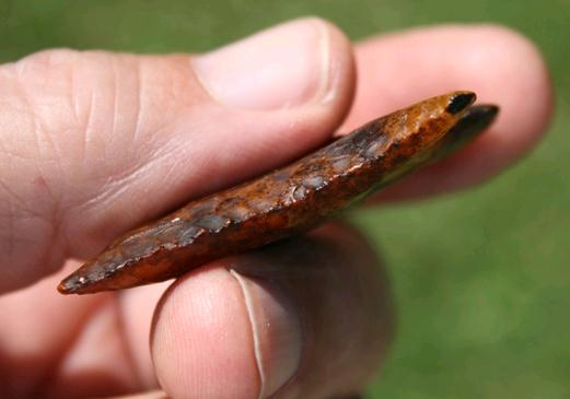
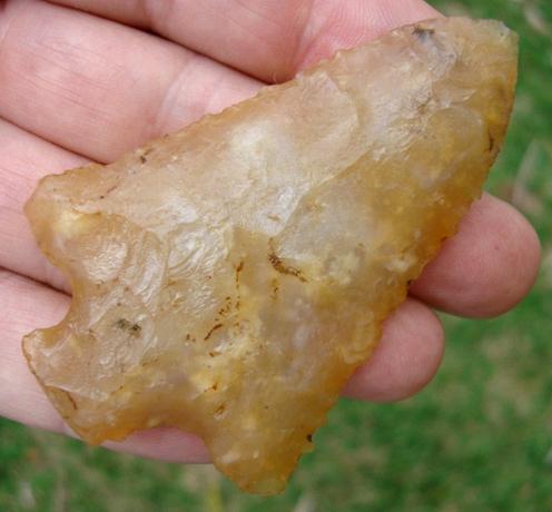
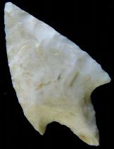
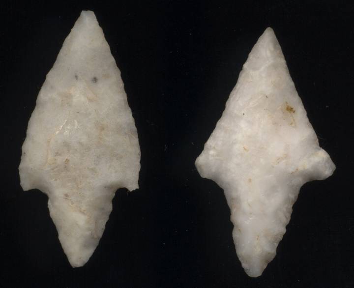
ABOVE: ABA03: Abasolo point; Kinney Co., Texas; 1.88 inches (47.7mm). Source: Art Gumbus, Lithics-Net
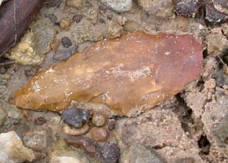
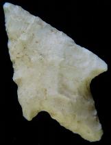
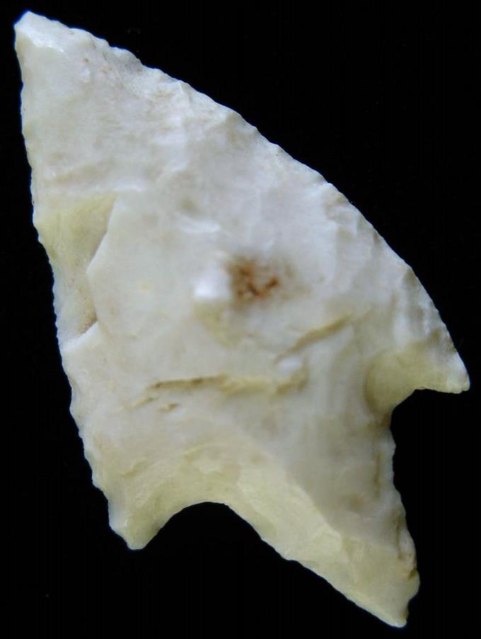
ABOVE: ABA04: Abasolo point; Texas coast (from Texasarrowheads dot com; first of two images
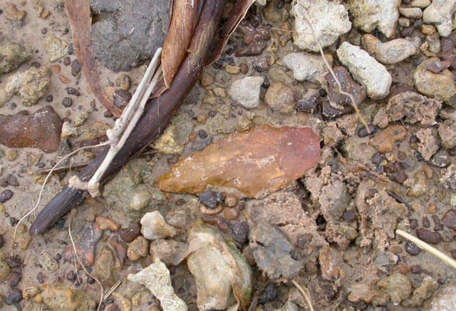
ABOVE: ABA05: second view of two of Abasolo point described above in frame #02. This one shows the point in situ. Source: Texasarrowheads dot com
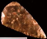
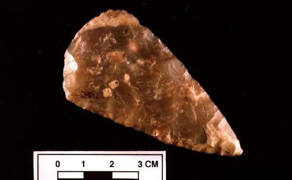
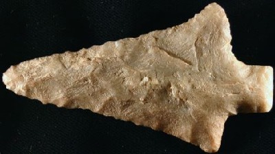
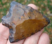
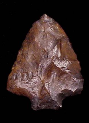
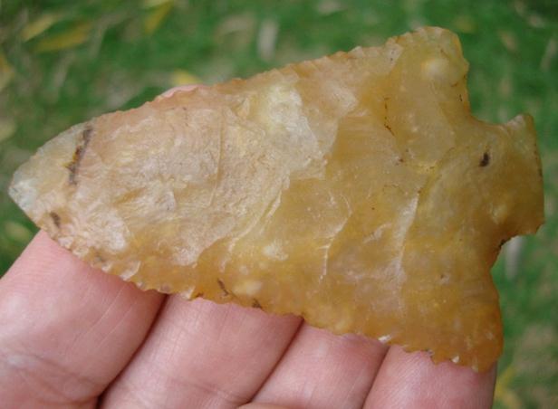
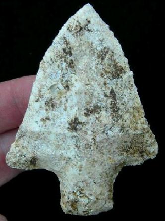
ABOVE: ABA06: Abasolo point; no location; 3.0 inches (76.2mm). Source: American-artifacts dot com
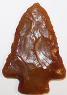
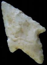
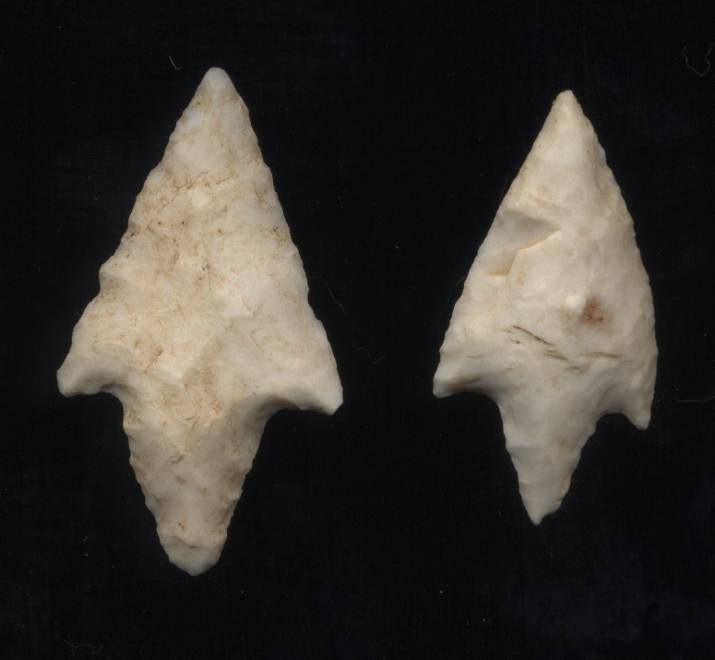
ABOVE: ABA07: Abasolo point; Texas. Source: Texasarrowheads dot com
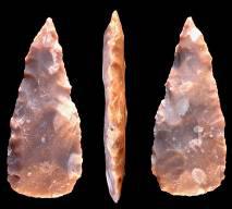
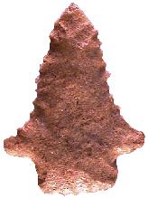
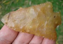
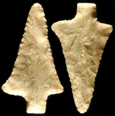
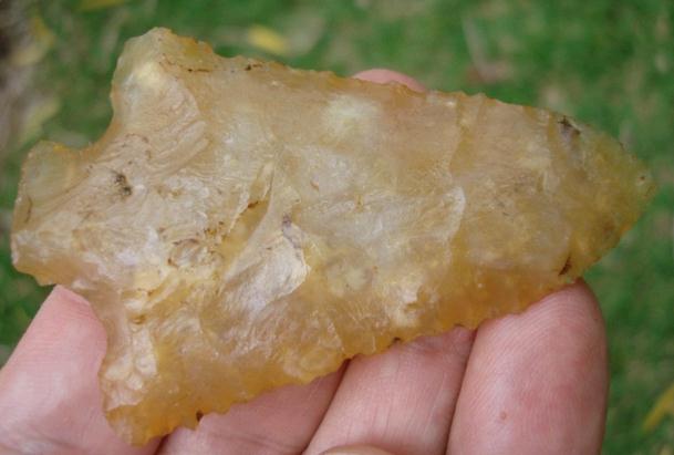
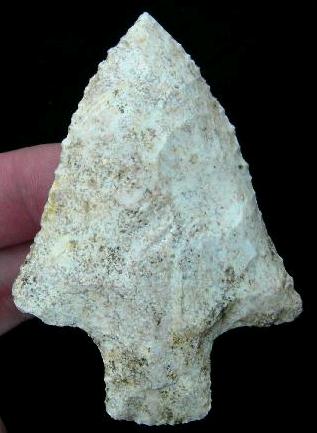
ABOVE: ABA08: Abasolo Point; Starr Co., Texas; 3.38 inches (85.8mm)
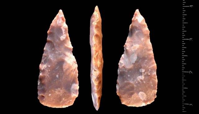
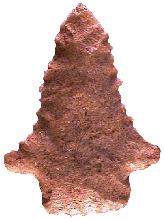
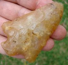
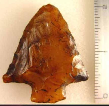
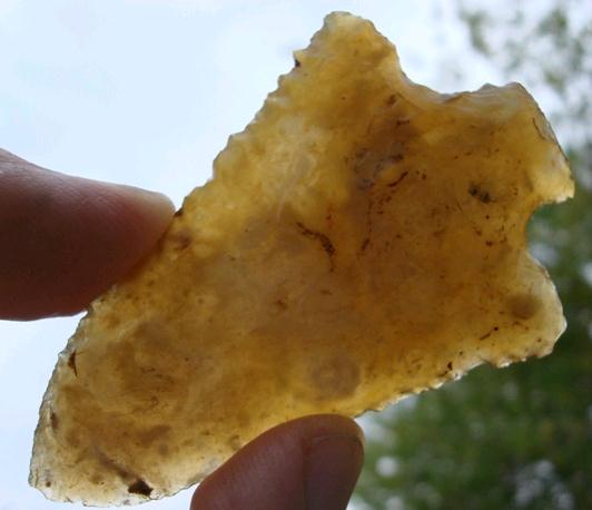
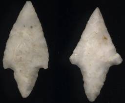
ABOVE: ABA09: Abasolo point; no location given; 2.5 inches (63.5mm); first of two views. Source: Premierartifacts dot com
ABOVE:ABOVE: ABA10: second of two views of Abasolo point described above. Source: Premierartifacts dot com Abbey Associated Dates: 6000 - 4000 Y.B.P. - Early Archaic to Middle Archaic Morphology: Stemmed Location: Extreme Southeastern United States especially Western Florida, South Alabama, Georgia
(ABBEY POINT THUMBNAIL GALLERY FOLLOWS TEXT DESCRIPTION)
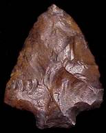
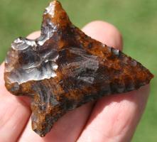
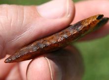
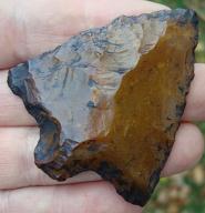
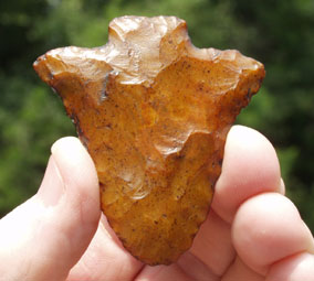
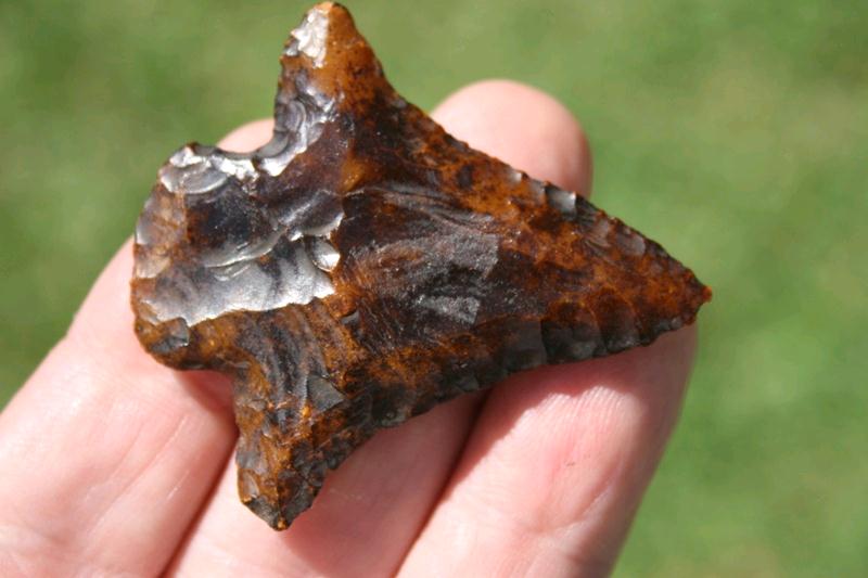
ABOVE: ABBEY01: Abbey point; no details General Description: The Abbey type is a medium sized, broad stemmed knife blade form that is fairly thick and flattened (hexagonal) in cross section and is very often steeply beveled on all four sides of each blade edge face. Blade edges are incurvate to straight to recurvate and can often exhibit serrations. The shoulders are expanded or broad and tapered and are usually horizontal. On some examples the shoulder barb can have a hooked appearance and can have sharp to rounded ends. The distal end is usually acute. The stem is usually straight but may be expanded. The basal edge may be either slightly convex or straight and is usually thinned. The Abbey usually exhibits well controlled, broad, shallow, random flaking. The Abbey embodies traits from both the Benton and Pickwick clusters. The Abbey is usually found in a totally exhausted or spent condition. The Abbey was typically reworked or resharpened by the employment of bifacial beveling or steeply angled pressure flaking that usually (but not always) left blade edges with serrations. (TEXT SOURCE: Art Gumbus, Lithics-Net)
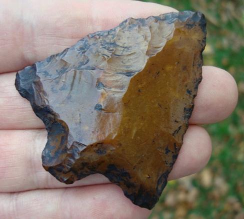
ABOVE: ABBEY02: Abbey point, 3.5 inches, Tallahatta Quartzite, from southern Alabama The Abbey can range in size from 38 mm to 66 mm in length, 32 mm to 49 mm wide at the shoulders and 6 mm to 9 mm in thickness. The stem length ranges from 7 mm to 12 mm and the stem width ranges from 14 mm to 25 mm. The type was first recognized by Ralph H. Allen Jr. and then named and described by David C. Hulse in 1964 for examples which he recovered from sites near the Abbey Creek in Houston and Escambia Counties, Alabama. The Abbey points were associated with Elora and Maples points at those sites. Note that Baker submits a new Abbey type which he calls the Abbey Broad Stem in his 1995 book. Perino suggests that the Abbey may be a worn out Maples point having the blade shortened due to repetitious resharpenings.
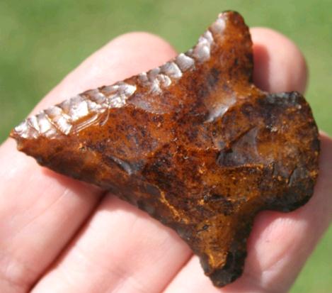
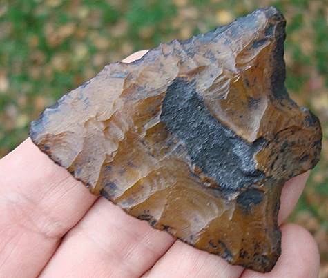
ABOVE: ABBEY03: Abbey point; see below for description About The Point Above: The beautiful tan and pink sugar quartz Abbey point pictured above represents the typical form for the type in a highly reworked, near discard condition. The point has been reworked to such an extent that most of the blade has been sharpened away leaving only pointed barbs which reveal the original width of the blade. The point measures 57 mm in length, 41 mm wide across the barbs and is 7.5 mm at its thickest point near the shoulders. The base tapers down to 3.5 mm in thickness. The blade edges are incurvate and have pronounced serrations considering the material. The stem is 12 mm long and 24 mm wide. This point was found along the banks of the Tombigbee River in Choctaw County, Alabama. ABBEY POINT THUMBNAIL GALLERY (48 images: 24 source images/24 thumbnails)
End of Abbey Thumbnails
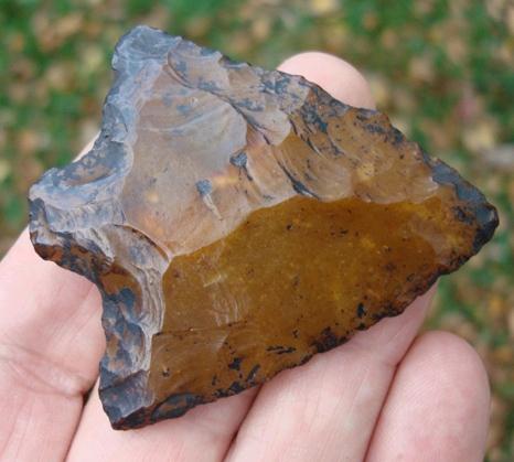
ABOVE, LEFT: ABBEY04: Abbey point; Choctaw Co., Alabama; 2.88 inches ABOVE, RIGHT: ABBEY05: Abbey point; Flint River, Georgia; 2.38 inches (59.5mm)
ABOVE: ABBEY06: Abbey point; Dougherty Co., Georgia
ABOVE: ABBEY07: Abbey points, all from southwest Georgia; from Sonandersonartifacts dot com. Interestingly enough, Son Anderson refers to these as “Abbey and Abbey-like,” although all appear to be classic Abbey points.
ABOVE, LEFT: ABBEY08: Abbey point; 2.25 inches (56.25mm)
ABOVE, LEFT: ABBEY10: Abbey point; 1.75 inches (43.75mm)
ABOVE: ABBEY12: Abbey point; southern Alabama; 3.5 inches (88.9mm); Tallahatta quartzite. Source: Earthworksartifacts dot com
ABOVE: ABBEY13: Abbey point; Flint River, Georgia; 2.13 inches (54.1mm); Coastal Plains chert; first of three views. Source: Roadrunnerartifacts dot com
ABOVE: ABBEY14: second of three views of Abbey point described above in frame #13. Source: Roadrunnerartifacts dot com
ABOVE: ABBEY15: third of three views of Abbey point described above in frame #13. Source: Roadrunnerartifacts dot com
ABOVE: ABBEY16: Abbey point; Flint River, Georgia; 2.56 inches (65mm); Coastal Plains chert; first of three views. Source: Roadrunnerartifacts dot com
ABOVE: ABBEY17: second of three views of Abbey point described above in frame #16. Source: Roadrunnerartifacts dot com
ABOVE: ABBEY18: third of three views of Abbey point described above in frame #16. Source: Roadrunnerartifacts dot com
ABOVE: ABBEY19: Abbey point; southern Georgia; 3.06 inches (77.7mm); Coastal Plains chert; first of four views. Source: Roadrunnerartifacts dot com
ABOVE: ABBEY20: second of four views of Abbey point described above in frame #19. Source: Roadrunnerartifacts dot com
ABOVE: ABBEY21: third of four views of Abbey point described above in frame #19. Source: Roadrunnerartifacts dot com
ABOVE: ABBEY22: fourth of four views of Abbey point described above in frame #19. Source: Roadrunnerartifacts dot com
ABOVE: ABBEY23 AND ABBEY24: Abbey point, described as first stage; Lee Co., Georgia; 3.25 inches (82.5mm); Coastal Plains chert. Source: Riversoftime dot com Acatita (a.k.a. “Cedral”) Associated Dates: 3000-2600 Y.B.P. Woodland ACATITA POINT THUMBNAIL GALLERY (14 images: 7 source images/7 thumbnails)
End of Acatita Thumbnails
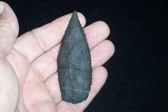
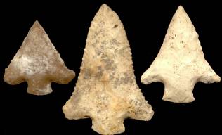
ABOVE: ACATITA01: Acatita points; West Texas; between 1.75 inches (44.4mm) and 1.18 inches (29.9mm); first of seven views. Source: Chris Merriam, Arrowheadsonline dot com
ABOVE: ACATITA02: second of seven views of Acatita points – enlargement of the two points seen above, left, in frame #01. Source: Chris Merriam, Arrowheadsonline dot com
ABOVE: ACATITA03: third of seven views of Acatita points described above in frame #01 – medium enlargement of the two points seen above, right, in frame #01. Source: Chris Merriam, Arrowheadsonline dot com
ABOVE: ACATITA04: fourth of seven views of Acatita points described above in frame #01 and shown second from right in frame #01. Source: Chris Merriam, Arrowheadsonline dot com
ABOVE: ACATITA05: fifth of seven views of Acatita points described above in frame #01 and shown second from right in frame #01. Source: Chris Merriam, Arrowheadsonline dot com
ABOVE: ACATITA06: sixth of seven views of Acatita points described above in frame #01 and shown at far right in frame #01. Source: Chris Merriam, Arrowheadsonline dot com
ABOVE: ACATITA07: seventh of seven views of Acatita points described above in frame #01 and shown at far right in frame #01. Source: Chris Merriam, Arrowheadsonline dot com End of Acatita - Complete Accokeek Associated Dates: 3000 - 1100 Y.B.P. (approximate dates only; more information needed; for example, references to Accokeek pottery time range is given as 2900 – 1700 Y.B.P. in one source, a survey covering Maryland and Virginia) Distribution: Type site is Accokeek Creek Site (18PR8; also known as Moyaone), Prince George Co., Maryland; possible territorial range includes the coastal plain of Maryland into Virginia to the James River Morphology: Stemmed More Info Needed
ABOVE: ACCOK01: Accokeek Creek Site, Prince Georges Co., Maryland; at confluence of Piscataway Creek and the Potomac River. Source: www.marylandhistoricaltrust.net Adder Orchard Associated Dates: 5000 – 3000 Y.B.P. Distribution: southwestern Ontario, “most notably from the Ausable Valley in the southeastern Huron basin” (Source: George Bradford, “Southern Ontario Projectile Points” (http://www.geocities.com/firefly1002000/pointsindex.html
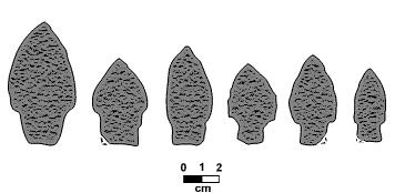
ABOVE: ADDER01: Adder Orchard point profiles. Source: George Bradford, “Southern Ontario Projectile Points” (http://www.geocities.com/firefly1002000/pointsindex.html)
ABOVE: ADDER02: Adder Orchard point profiles as presented by the Ontario Archaeological Society, London Chapter http://www.ssc.uwo.ca/assoc/oas/points/adder.html General Description: (the following is from the Ontario Archaeological Society, London Chapter http://www.ssc.uwo.ca/assoc/oas/points/adder.html): "AGE AND CULTURAL AFFILIATION: Late Archaic. Similar points have been found at the Pinegrove Cemetery in Michigan, which has C-14 dates of 1060 BC. and 1355 BC. (Simons 1972). A C-14 date from Adder Orchard of 1900 +/- 90 B.C. is also considered acceptable (Kenyon 1983). These points probably date between 2000 and 1000 BC. These points represent a distinct type related to the "Christmas Tree" points of the Satchell complex (Kenyon 1980b). Adder Orchards are also similar to Stringtown points in Ohio, which have been mistakenly identified as being Plano (Prufer and Baby 1963). REMARKS: It has been suggested (Kenyon 1983: 11) that Adder Orchard points might be slightly later than the broad-bladed "Christmas Tree" points, and may represent an evolving regional variant. While points evolving from Genesee's in the east (Niagara Peninsula and New York) retain a basic Trianguloid blade shape, through time their stems become more contracted and shorter. Adder Orchard points, on the other hand, appear to represent a western variant, for which long, parallel sided stems are retained, but whose blades become increasingly narrower and more excurvate. SIZE: Point measurements from the Adder Orchard site are: Length = 41-78 mm (mean of 59.3); Shoulder Width = 19-38 mm (28.4); Stem Width = 16-27 mm (22.7); Base Width = 15-24 mm (19.7); Blade Length = 26-54 mm (40.0); Shoulder Height - 14-27 mm (19.6); Stem Length = 12-26 mm (17.4); Thickness = 7-15 mm (10.0). SHAPE: Adder Orchard stemmed points have narrow lanceolate blades, and are distinctive by their excurvate blade shape, the point of maximum width usually being well above the shoulder. Shoulders tend to flare out slightly from the stem. Occasionally these points are marked by a slight spur which projects laterally from the base. Stems are parallel-sided to contracting in shape. FLAKING: Flaking is usually well executed. Primary retouching consists of wide, expanding flake scars. Secondary or marginal retouching is used where it is required to produce an even, sharp edge. Stems are often lightly ground or rubbed, but not to the degree visible on many Paleo-Indian and earlier Archaic points. RAW MATERIAL: At the Adder Orchard site, points from Kettle Point chert represent 58% of the collection. Onondaga Chert is represented in about a third of the specimens, while only two points were made from greywacke (Kenyon 1983). REFERENCE: Ferris, N. and I. Kenyon. - 1987 Adder Orchard Points. KEWA 87-5. ( Text of Original Publication)" |
|
©2010 J Keffer |